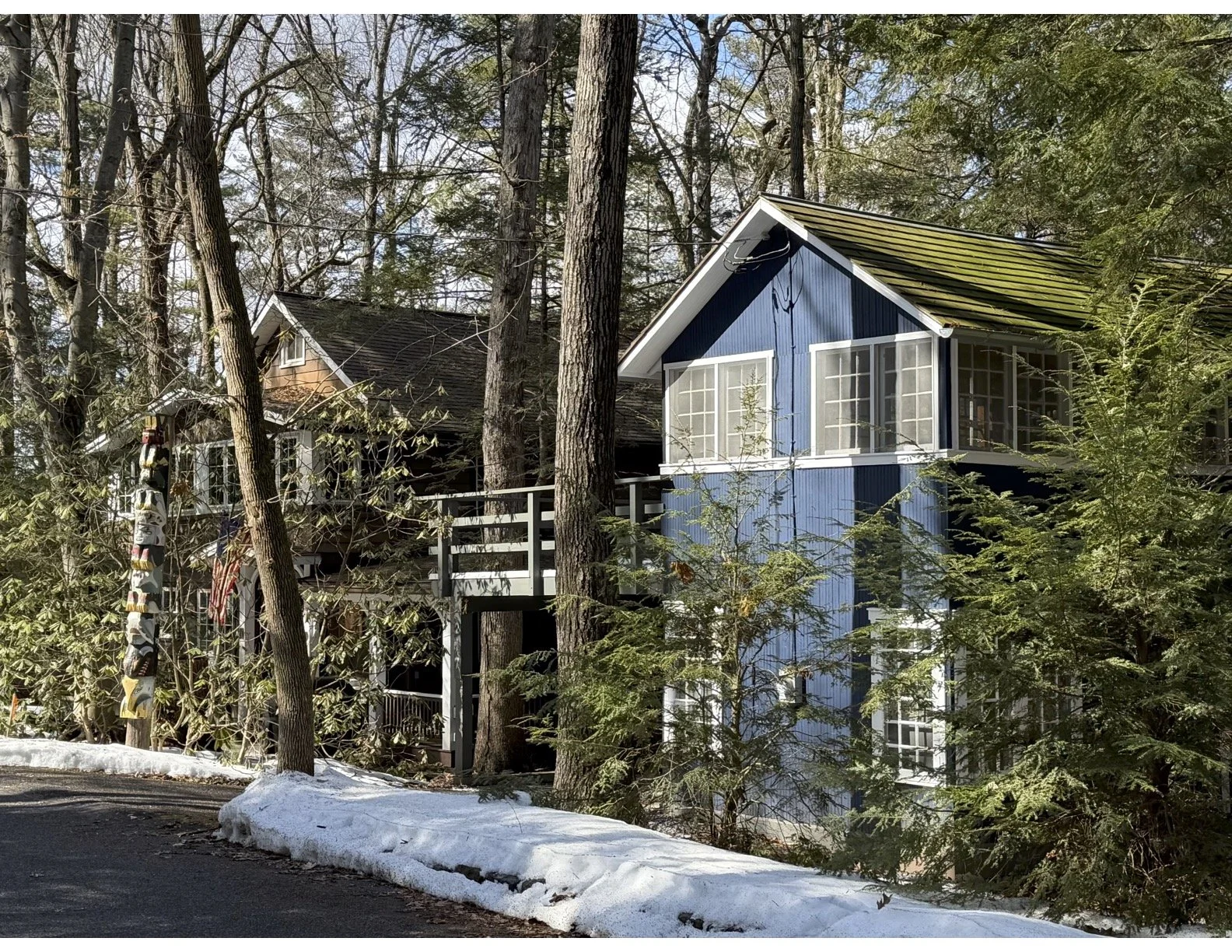
Understanding Mount Gretna & Pennsylvania Chautauqua
Pennsylvania Chautauqua is one of several distinct neighborhoods within Mount Gretna—but it is also its own incorporated borough with its own local government and services.
Because of this, people often use “Mount Gretna” and “Chautauqua” interchangeably. In reality, Mount Gretna is the broader community, made up of multiple neighborhoods, each with its own character, governance, and history.
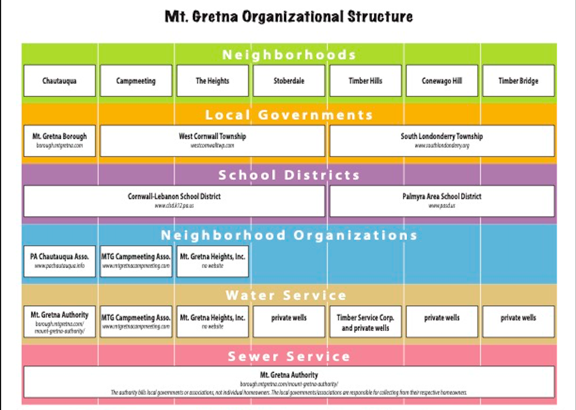
How Mount Gretna Is Organized
This diagram provides a simplified overview of the Mount Gretna area, including neighborhoods, local governments, school districts, and community organizations.
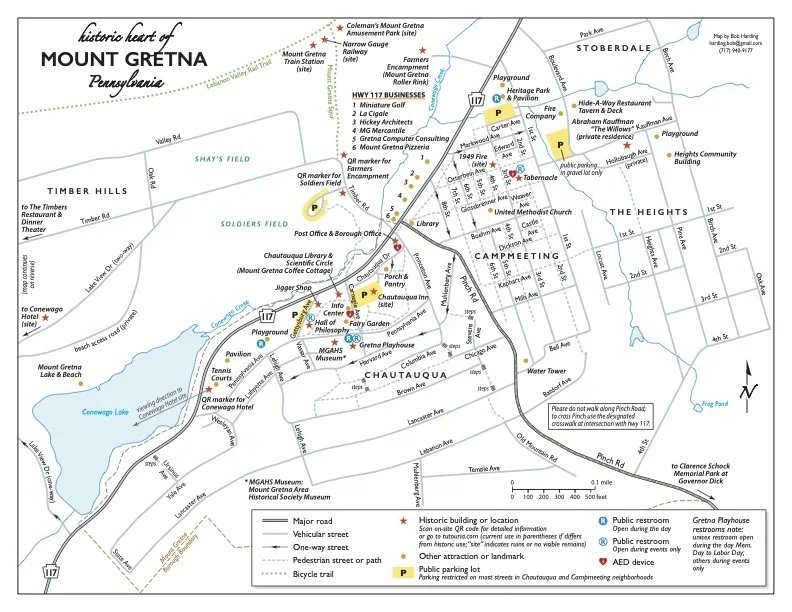
Explore the Area
This map provides an overview of Mount Gretna, including neighborhood boundaries, key landmarks, and important community locations.
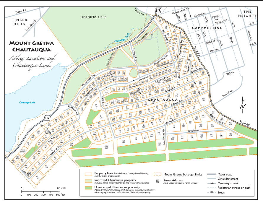
Understanding Chautauqua Lands & Addresses
This reference map highlights Pennsylvania Chautauqua property boundaries, address locations, and major community areas within the historic Chautauqua neighborhood.
Community Snapshot
Mount Gretna includes several distinct neighborhoods and seasonal communities, each with its own character and governance structure. The census and housing report below provides additional demographic information about the greater Mount Gretna area.
View 2020 Census & Housing Data PDF
Includes 2020 Census population and housing information for Mount Gretna Borough, Timber Hills, and Mount Gretna Heights.